In Short
Advice
Discovering the secrets behind Thailand's Regulation-Designated Land Use Areas, specifically the crucial "water catchment areas" and "drainage areas." These areas play a vital role in preventing flooding and have piqued the curiosity of many Bangkok residents. Join us as we delve into the details and uncover the significance of these designated zones in our latest blog post.

What is a Water Catchment Area?

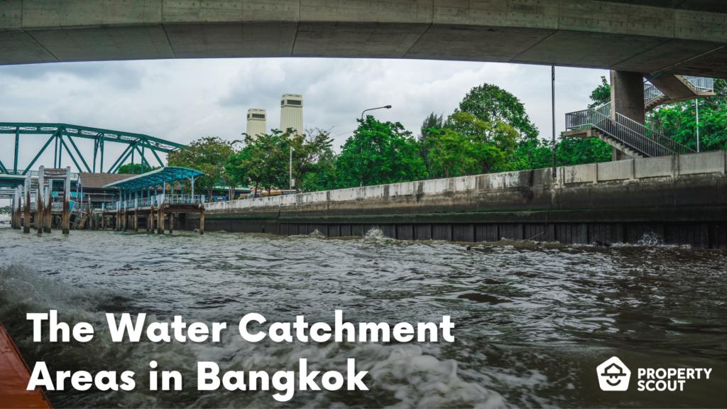
The water catchment areas, which are part of flood prevention measures, refer to designated zones with a distinctive "light green color and diagonal green lines." These areas serve to store water and mitigate flooding along the eastern banks of the Chao Phraya River, addressing the flooding issues on the eastern side of Bangkok. Established since 1980 (B.E. 2523), these water catchment areas encompass privately owned land and allocated village areas, as well as public catchment areas under the supervision of the Bangkok Metropolitan Administration and various governmental and state enterprise agencies.
Origins
Since the reign of King Rama V and the establishment of the Department of Public Works in 1889, Thailand has maintained a system of land use regulations and controls. One notable milestone is the "Comprehensive Urban Plan of Bangkok 2013 (B.E. 2556)", which reflects the latest urban land use guidelines for the capital city.
While we are acquainted with the familiar color-coded land use zones, such as the red zone for industrial areas and the brown zone for densely populated residential areas, there's more to these regulations than meets the eye. Hidden beneath their surface lies a comprehensive framework encompassing transportation and infrastructure projects, including the transportation master plan and public utilities initiatives like canal dredging and water drainage plans.
Furthermore, these regulations extend beyond built environments, encompassing meticulous land use plans for open spaces. Notably, some of these designated areas serve as essential water catchment zones.
Where are the water catchment areas in Bangkok?

There are currently 25 water catchment areas throughout Bangkok with a total capacity of approximately 13.04 million cubic meters. These catchment areas are predominantly located in the central region of Bangkok.
- Pathumwan district
- Klongtoei district
- Phayathai district
- Bangkapi district
- Prawet district
There are two water catchment areas currently under construction, with an additional water capacity of approximately 316,700 cubic meters.
- Ramkhamhaeng, Saphan Sung district: The catchment area for Sammakorn Village Pond and the Seri Thai Garden, stretching from Khlong Rahaad to Khlong Kru.
Water catchment areas have been expanded with the addition of approximately 12 new locations, primarily distributed across the urban belt of Bangkok, such as...
- Areas such as Sai Mai District and Klong Sam District, encompassing both public and private spaces, are expected to contribute to an estimated increase of approximately 6.18 million cubic meters in water catchment capacity.
What is Drainage Area? How does it differ from Water Catchment Area?

In addition to water catchment areas, there are also "drainage areas" categorized as Level 4 zones. These areas are characterized by a "white color with diagonal green lines" and serve to preserve the natural water drainage system. They are divided into two sides of Bangkok, namely the eastern and western sides, distributed across various districts as follows:
Eastern side
- Klongsam Wa district
- Minburi district
- Ladkrabang district
Western side
- Talingchan district
- Thawi Wattana district
- Bangkae district
- Phasi Charoen district
Dealing with a Sudden Flood
In the event of a sudden flood without prior warning or time to prepare, it is crucial to prioritize personal safety over property. Here are some recommendations on how to handle such situations:
- Sandbags are strongly recommended for high-risk areas in order to construct barrier to prevent water from entering homes.
- Store important documents such as ID cards, house registration book copies, birth certificates, or title deeds in ziplock bags to prevent water damage.
- Ensure that your pets wear a collar containing your contact information, including your name and phone number, for easy tracking in case they go missing.
- Make sure your cell phones are fully charged and prepare backup equipment such as power banks, flashlights, and charging cables.
- Elevate objects, prepare dry foods, water, medicine, and floatation devices.
- Unplug your entire house and cover your plug holes with tape to prevent electrical leakage.
- Park your vehicles somewhere elevated or safe, or cover it with a car cover blanket in case the flood isn't very excessive.
- Evacuate patients, children, and the elderly to safety or to the facilities provided by supporting organizations.
- If you're driving, park and exit the vehicle immediately. Refrain from driving or reversing into the flooded area.
- If you receive a sudden flood warning, evacuate to higher ground immediately. If you are outside your home, try to find a nearby elevated location such as a hill, suspension bridge, tall building, or high-rise. If there is no nearby high ground, it is recommended to cling to large objects for safety.
- Do not walk along flowing water, even if the water level is not high, as the speed of the water can cause you to lose your footing and be swept away, potentially leading to drowning.
- If you see a power pole or power lines, avoid getting close to them, and if possible, promptly notify the relevant authorities.
Emergency Contact

- Department of Disaster Prevention and Mitigation: Call 1784
- National Disaster Warning Center: Call 192
- Thai Meteorological Department: Call 1182
- Royal Irrigation Department: Call 1460
- Water Safety Center: Call 1199
- Emergency Medical Service: Call 1669
Channels for tracking news/information and receiving flood warnings
Disaster alerts, checking water conditions, and water information in each watershed area:
Weather forecast
Landslide risks
Weather information and water system updates for dams and coastal areas
Disaster information and warning
Disaster information, warning, and rescue
Water levels in reservoirs, rivers, and water release information
Conclusion
We hope that this article proves helpful to all readers. While water catchment areas are predominantly found on the eastern side of Bangkok, the western side also benefits from flood mitigation initiatives such as the "Khlong Mahachai-Sanam Chai Canal." These projects provide reassurance to residents in the upper western region, ensuring a more secure living environment.
Looking to stay nice and dry in the rainy season? Get in touch with us today and let our consultant team find the perfect new home for you!
FAQs
Lorem ipsum dolor sit amet, consectetur adipiscing elit. Suspendisse varius enim in eros elementum tristique.
Explore More Topics
Free real estate resources and tips on how to capitalise


